Navigating Without Tech: Reliable Technology for When Devices Fail


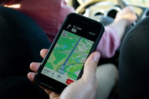
Modern navigation is almost inseparable from technology. GPS apps guide us through unfamiliar cities, digital compasses keep us oriented, and satellite devices track our exact locations in remote areas. However, even the best technology can fail—batteries die, devices break, and signals get lost in valleys, forests, or storms. When that happens, having traditional navigation skills can make the difference between finding your way home and getting stranded.
These methods aren’t just for wilderness explorers; they’re valuable in everyday life. From power outages during natural disasters to simply losing cell service in a rural town, knowing how to read the land, the stars, and even the wind can give you confidence and independence. The following techniques highlight timeless practices that people have employed for centuries, long before digital maps existed.
Using the Sun as a Guide
One of the most basic navigation tools is the sun. Since it rises in the east and sets in the west, travelers can use its position to get a general sense of direction. In the morning, the sun will be in the east, casting long shadows to the west, and by late afternoon, the roles reverse. At noon, in the Northern Hemisphere, the sun is positioned generally toward the south, while in the Southern Hemisphere it tilts northward.
Shadows can also be used to find direction. By placing a stick upright in the ground, you can mark the tip of the shadow, wait 15–20 minutes, and mark the new position. Drawing a line between the two points creates an east–west line, giving you a reliable orientation even without a compass.
Navigating with the Stars
When the sun sets, the night sky becomes a natural map. In the Northern Hemisphere, Polaris, the North Star, has long been a trusted guide. Located at the end of the Little Dipper’s handle, it sits almost directly above the North Pole. Once located, it points you north and helps you establish all other directions.
In the Southern Hemisphere, travelers can turn to the Southern Cross constellation. Drawing an imaginary line along its long axis and extending it several times points toward the south celestial pole. These stellar methods have guided sailors across oceans for centuries and remain reliable when modern tools are unavailable.
Reading the Landscape
Nature itself provides subtle but consistent clues. For example, moss tends to grow thicker on the north side of trees in the Northern Hemisphere, though it’s not always perfect. Similarly, snow may linger longer on northern slopes, while southern slopes receive more sunlight and melt faster. These observations can help you determine orientation in areas where other methods are limited.
Bodies of water, valleys, and ridges also act as natural pathways. Rivers often lead to human settlements, and ridgelines can provide clearer paths than dense forests. By paying attention to these land features, you can align yourself with the environment instead of feeling lost within it.
Map and Compass Skills
A paper map and a compass remain two of the most dependable tools for navigation. Unlike digital devices, they don’t require batteries or internet access. Learning to align a compass with a map, take bearings, and plot routes is an essential survival skill.
Topographic maps provide even more detail, showing elevations, water sources, and trails. By comparing the map’s contour lines with the land around you, you can match terrain features and confirm your position. With practice, these methods can be faster and more accurate than relying on GPS.
Observing the Weather and Wind
Weather patterns also carry navigational clues. In many regions, prevailing winds blow from consistent directions. For example, in the United States, weather generally moves from west to east, which can offer guidance if other indicators are unclear.
Cloud formations can signal changes in direction and time of day. The movement of storm systems, or even the shape of clouds as they build and dissipate, can give hints about orientation. Mariners have used such cues for centuries, and they remain practical in situations where electronics can’t provide answers.
Following Signs of Human Activity
In both wilderness and rural areas, signs of human presence can guide you toward safety. Trails, fences, power lines, and even livestock paths often lead to roads or settlements. Listening for distant sounds, like traffic, running water, or church bells, can also help identify civilization’s direction.
Even in remote regions, specific patterns indicate habitation. Rivers and streams frequently lead to villages, while roads and railways tend to connect major areas. Recognizing and following these signs can help shorten your journey when you’re uncertain about where you are.
Practicing Situational Awareness
The most crucial technique is paying attention from the start. Many people rely so heavily on GPS that they stop noticing their surroundings. But by observing landmarks, counting turns, or noting the shape of the horizon, you can create a mental map that prevents you from getting lost in the first place.
Practicing these habits regularly will sharpen your natural sense of direction. If technology suddenly fails, you won’t feel helpless—you’ll already have the awareness and confidence to rely on your own knowledge.
Confidence Beyond Technology
Technology makes navigation easier, but it should never replace basic survival skills. By learning to read the sun, stars, land, and weather, and by practicing with maps and compasses, you gain independence that no app can provide.
These skills are more than just backup plans; they connect us to centuries of human exploration. When technology fails, those who know these timeless techniques will not only survive but thrive, navigating with confidence and respect for the natural world.


